

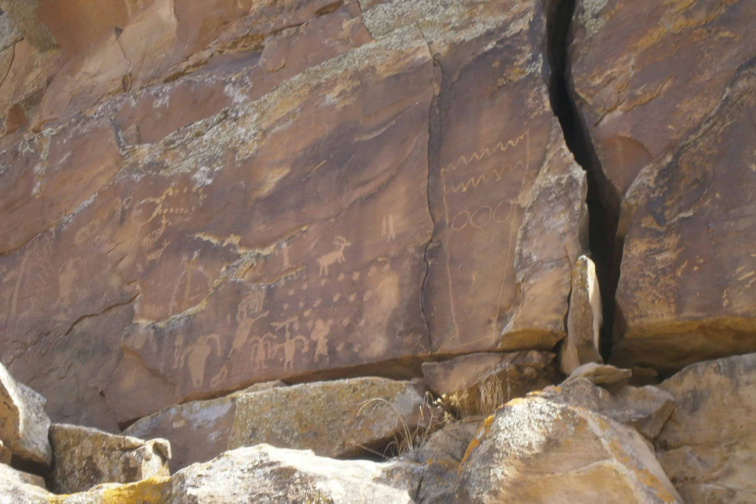
Nine Mile Canyon Rock Art Lawsuit Challenges Utah Road Approval

Three preservation and environmental organizations have sued the U.S. Bureau of Land Management over its approval of a right-of-way amendment for the federally managed portion of a proposed 5.3-mile road reconstruction in Utah’s Gate Canyon. The complaint says construction and the traffic it enables threaten the connected Nine Mile Canyon cultural landscape, but the court has not ruled on those allegations—and the approved work is not the same thing as an order to blast Nine Mile Canyon’s best-known petroglyph panels.
What the BLM Approved—and Where
The agency’s official project record describes the Wells Draw Road Amendment–Gate Canyon as a reconstruction of approximately 5.3 miles. It places 2.7 miles on BLM-administered land and 2.6 miles on land administered by the Utah Trust Lands Administration. The route runs from the summit of Gate Canyon to existing pavement about half a mile north of the intersection with Nine Mile Canyon Road.
That geography matters. The project would realign and pave an unimproved road with sharp curves and limited sightlines in Gate Canyon; it does not run along all 46 miles of Nine Mile Canyon. The BLM nevertheless presents Gate Canyon as the northern approach in its own visitor description of Nine Mile Canyon, which it calls the “world’s longest art gallery.”
The plaintiffs—Nine Mile Canyon Coalition, Southern Utah Wilderness Alliance, and Center for Biological Diversity—make two distinct cultural-harm claims. They allege that blasting and road work would affect historic and archaeological resources inside Gate Canyon, and that heavier traffic, dust, noise, and air pollution would threaten the adjoining Nine Mile Canyon landscape. Those are allegations, not findings by the court. Describing the approval simply as permission to demolish the famous Nine Mile petroglyphs would erase the difference between the project footprint and its alleged indirect effects.

The Public Project Record Spans 43 Days in 2026
Taken together, the BLM’s current project record and the filed complaint supply a chronology that is more precise than the shorthand of a newly “revived” road plan. It also shows that the 2026 public project record ran only 43 days from its listed start to the decision.
| Date | What the record shows |
|---|---|
| 2015 | The complaint describes a BLM draft assessment of an earlier version; it was never finalized. |
| Dec. 2022–2023 | BLM opened another review and held public scoping, then terminated that assessment pending other agencies’ review of resource surveys. |
| Mar. 16–Apr. 28, 2026 | A replacement assessment began and BLM approved the right-of-way amendment. |
| Oct. 6, 2026 | The three organizations filed their federal complaint. |
The earlier administrative process was not simply canceled. BLM says the right-of-way application remained active while the 2023 assessment was terminated, and that its 2026 assessment replaced the prior draft with updated documents, maps, and information. On April 28, the agency issued a final environmental assessment, decision record, and finding of no significant impact.
The complaint gives the same sequence a sharply different legal meaning. It alleges that BLM posted only a generic description and map on March 16, denied or did not answer requests for public participation, and released the final documents when it approved the project. Whether that process satisfied federal law is one of the questions before the court; the short public timeline alone does not decide it.
Why the Rock Imagery Is More Than Scenery
Nine Mile Canyon’s importance is visible in individual compositions as well as in the density of the whole landscape. The National Park Service describes the Great Hunt Panel Site as five prehistoric rock-art panels with motifs spanning the Archaic through Fremont periods. Its best-known composition includes at least 30 bighorn sheep and eight humanlike figures arranged in a scene interpreted as a communal hunt.
That combination of figures, animals, placement, and rock surface is why the works cannot be treated like portable objects. The canyon setting is part of how they are encountered and understood. Nine Mile’s imagery belongs within the wider history of Native American art, but its conservation problem is inseparable from access, road dust, vibration, erosion, and the integrity of the surrounding cultural landscape.
The Great Hunt Panel clarifies the artistic stakes, but it should not be mislocated in the lawsuit. The complaint does not say that this particular panel will be blasted. Its direct-footprint allegations concern Gate Canyon, where the plaintiffs quote earlier project documents identifying historic sites—many described as axle-grease inscriptions—close to Wells Draw Road. The Nine Mile rock-imagery claim concerns the connected landscape and the effects the plaintiffs expect from increased traffic.
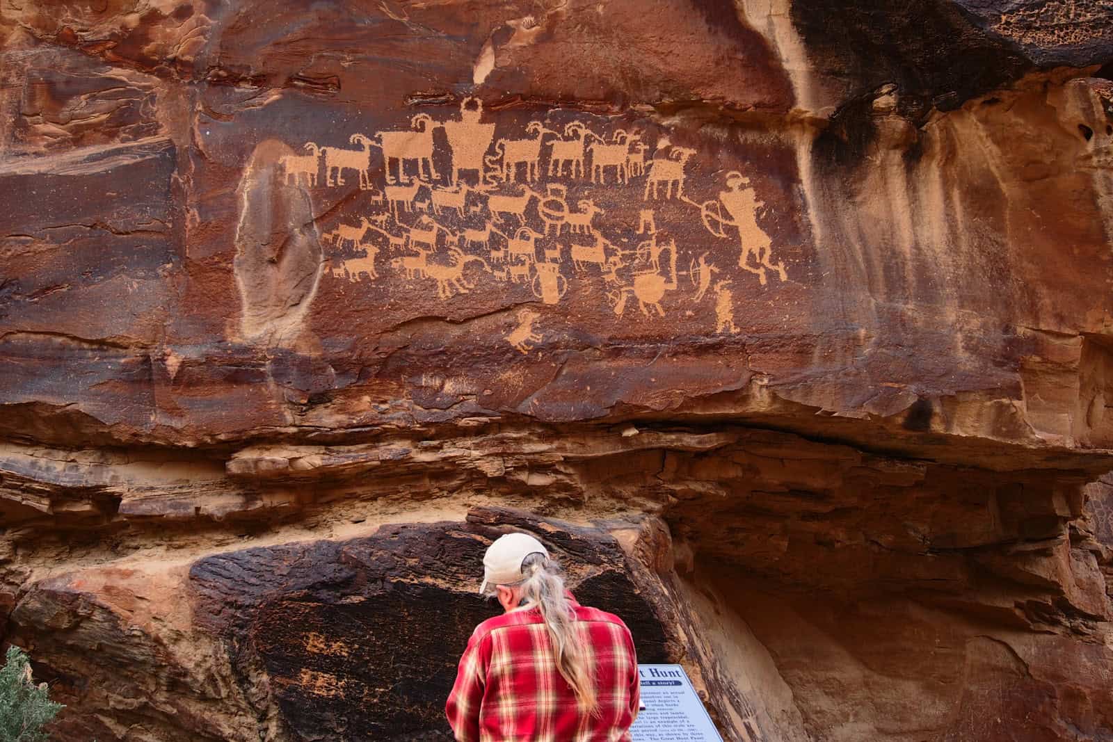
Hunt-scene petroglyphs along the Nine Mile Canyon National Backcountry Byway. Photograph by Sandy Brown Jensen, via Wikimedia Commons. Creative Commons Attribution 2.0 Generic; cropped.
What the Complaint Alleges—and What It Does Not Prove
The 50-page federal complaint, filed as case 2:26-cv-00932, alleges violations of the National Environmental Policy Act, Federal Land Policy and Management Act, National Historic Preservation Act, Endangered Species Act, and Administrative Procedure Act. It asks the U.S. District Court for the District of Utah to vacate the 2026 approval and halt action under it until the agencies comply with those laws.
For cultural resources, the most consequential material is not a new damage report. The plaintiffs quote a 2015 BLM draft assessment as identifying 47 historic sites in Gate Canyon, 43 considered eligible for the National Register of Historic Places, with 11 within 10 feet of the proposed action. They also quote a 2022 plan prepared for the county as saying cultural sites were abundant and that a few would be destroyed. The complaint then alleges that the 2026 assessment failed to identify or analyze those resources adequately.
Those citations establish what the plaintiffs have put before the court, not that the older figures control the outcome or that a violation has occurred. BLM’s public page establishes that it approved the project and issued a finding of no significant impact; it does not answer the complaint’s detailed comparison of the earlier and later reviews. The distinction between documented condition and projected environmental harm also shapes the conservation debate around industrial exposure and Murujuga rock art: risk, monitoring, and proven physical damage are related questions, not interchangeable ones.
The project’s oil-truck purpose is also contested in presentation. BLM describes a regional transportation corridor and a safety-driven reconstruction. The plaintiffs say the straighter paved route is intended to facilitate oil traffic from the Uinta Basin and rely on older estimates of 700 to 1,000 vehicles per day, about half heavy trucks. The 2026 approval does not itself establish that those volumes will occur.
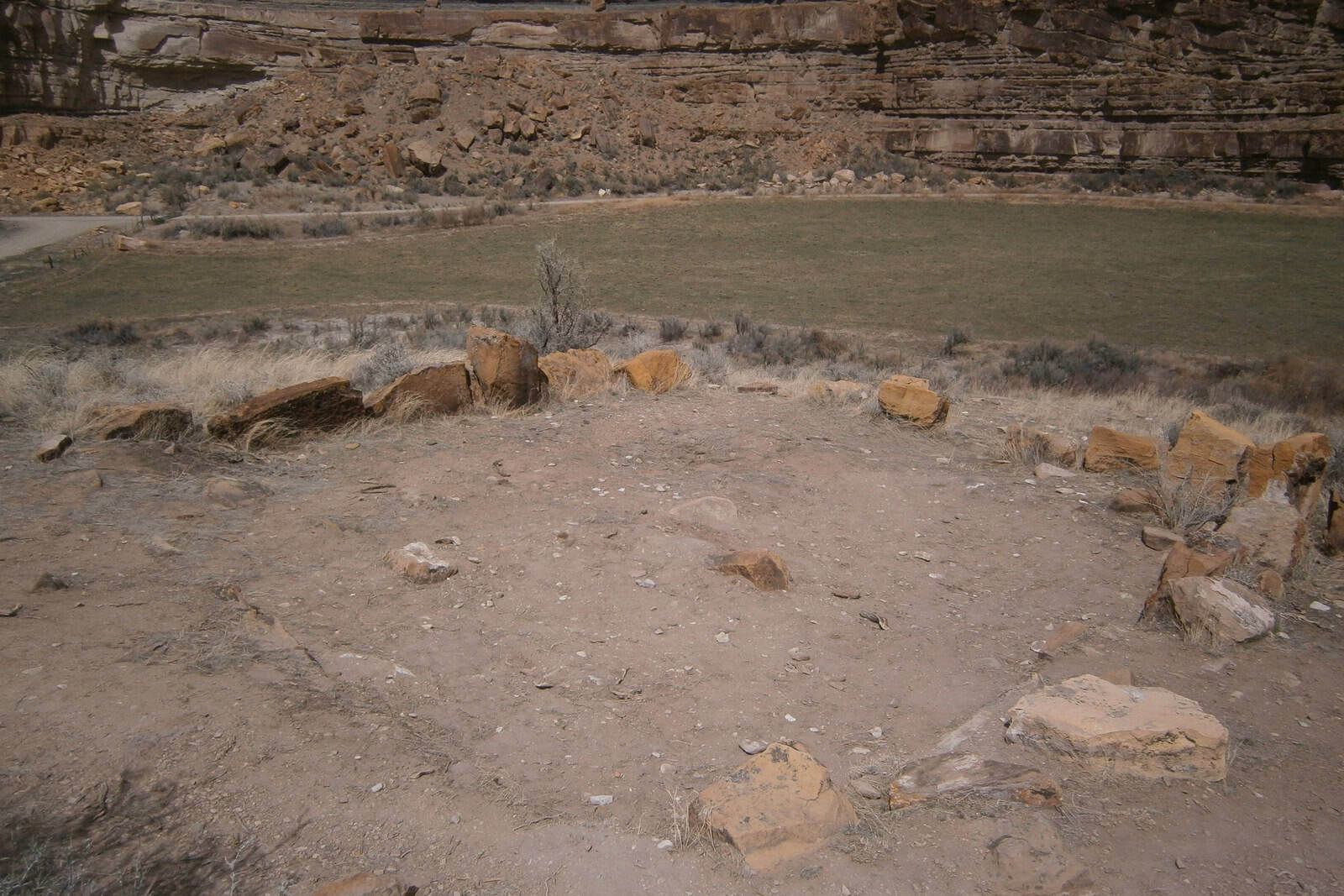
Remnants of a Fremont pit house at Cottonwood Village in Nine Mile Canyon. Photograph by Ntsimp, via Wikimedia Commons. CC0 1.0; cropped.
What Is Established Now
- BLM approved a 5.3-mile Gate Canyon road reconstruction on April 28, 2026, ending about half a mile north of Nine Mile Canyon Road.
- The October 6 complaint challenges that approval and alleges both direct harm to Gate Canyon resources and indirect harm to Nine Mile Canyon’s rock-imagery landscape.
- The plaintiffs’ strongest cultural-resource numbers come from earlier project records quoted in the complaint: 47 Gate Canyon sites, 43 considered National Register-eligible, and 11 within 10 feet of the proposed action.
- The National Park Service record confirms the national significance and compositional complexity of Nine Mile Canyon rock art, but it does not place the Great Hunt Panel inside the approved construction footprint.
No merits ruling has determined that BLM violated federal law or that the predicted traffic and conservation harms will occur.

Isabella studied at the University of Cape Town in South Africa and graduated with a Bachelor of Arts majoring in English Literature & Language and Psychology. Throughout her undergraduate years, she took Art History as an additional subject and absolutely loved it. Building on from her art history knowledge that began in high school, art has always been a particular area of fascination for her. From learning about artworks previously unknown to her, or sharpening her existing understanding of specific works, the ability to continue learning within this interesting sphere excites her greatly.
Her focal points of interest in art history encompass profiling specific artists and art movements, as it is these areas where she is able to really dig deep into the rich narrative of the art world. Additionally, she particularly enjoys exploring the different artistic styles of the 20th century, as well as the important impact that female artists have had on the development of art history.
Learn more about Isabella Meyer and the Art in Context Team.
Choose Art in Context as a preferred source to see more of our reporting in Google Top Stories and other Google Search experiences.
Cite this Article
Isabella, Meyer, “Nine Mile Canyon Rock Art Lawsuit Challenges Utah Road Approval.” Art in Context. October 14, 2026. URL: https://artincontext.org/nine-mile-canyon-rock-art-road-lawsuit-2026/
Meyer, I. (2026, 14 October). Nine Mile Canyon Rock Art Lawsuit Challenges Utah Road Approval. Art in Context. https://artincontext.org/nine-mile-canyon-rock-art-road-lawsuit-2026/
Meyer, Isabella. “Nine Mile Canyon Rock Art Lawsuit Challenges Utah Road Approval.” Art in Context, October 14, 2026. https://artincontext.org/nine-mile-canyon-rock-art-road-lawsuit-2026/.


